BERGHAUS HERMANN
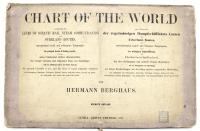
Chart oft the world on Mercators projection entirely reconstructed by Hermann Habenicht (fort he sea) and Bruno Domann (for the land).
Date: Gotha,1863 - 1871
World
Cod 3475
Subject: World
2.000,00 €
Colour lithograph, 920x1560 mm, mounted on editorial cloth in 12 cuts. This enormous map of the world in colonial times was published by Justus Perthes in Gotha in 1863 and revised several times over the years, with editions known until 1909. This incredibly detailed and precise world map was designed by the important German cartographer Hermann Berghaus and is one of the most impressive productions of the 'Gotha School' of cartography, which prioritised accuracy and scientific clarity. Among other things, it contains many panels at the bottom with a wind chart, a list of the main ocean navigation companies, a map of the world's telegraph lines, and polar hemispheres. Winds, floating ice boundary lines and shipping and trade routes are indicated in the map. It is an interesting document of the world in the late 19th century related to great oceanic navigation, illustrating the importance of the expansion of global trade, then facilitated by the rapid improvements of steamships and the increasing openness of Asian markets. The density of information is impressive, showing topographical, Arctic and sub-Arctic features, political data, railway routes, sea routes, ocean currents, winds, magnetic variations and more. Inserts in the lower quadrants of the map illustrate global telegraph lines, steamship routes and provide a polar projection. Published in English for the world market, it was a great success and went through fourteen regularly updated editions until 1909. The latest editions, like the present one, were revised by Berghaus' colleagues Hermann Habenicht and Bruno Domann. Hermann Berghaus (1828 - 1890) was an esteemed cartographer employed by the Perthes Institute and grandson of the world-renowned cartographer Heinrich Berghaus (1797 - 1884). Hermann was renowned for his attention to detail, so much so that his eyesight failed due to the countless hours spent correcting minutiae. The sequence comprising the present map is perhaps his most famous work; however, he is also known for his wall map of Africa, Wand-Karte von Afrika (c. 1881) and his revision of his uncle's Physikalischer Atlas (1886).

Back